



Heavy rain is causing flooding, slips and fallen trees across parts of Canterbury and the West Coast.
State Highway 6 between Punakaiki and Fox River has been closed because of a slip at Meybille Bay.
NZTA Waka Kotahi said flooding was also occurring on several highways between Greymouth, Reefton and Murchison.
Snow was also affecting higher parts of the South Island, including Lindis Pass, with people urged to take extra care on the roads.
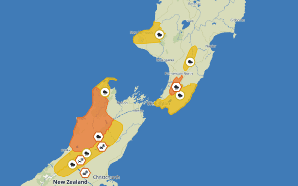
MetService’s website shows locations covered by warnings and watches at 11am Sunday.
MetService / Screenshot
Up to 200 millimetres of rain was expected in the ranges today.
MetService said a large trough is crossing central New Zealand on Sunday and early Monday, bringing heavy rain and potentially snow to mountain passes.
An orange-level warning is in place for Grey and Buller Districts, and Nelson Lakes, from 9am Sunday until 1am Monday.
The MetService warning issued at 9:17am said residents should expect “a further 100 to 140 mm of rain about the ranges on top of what has already fallen,” and 50-70 mm elsewhere.
It said peak intensities of up to 25mm/h were expected this afternoon and early evening.
At the same time, it issued a heavy rain warning for the Tararua Range, effective from 5pm Sunday until 3pm Monday, with up to 150 millimetres expected overnight.
It said there was a “minimal chance” of the either warning being upgraded, but urged people to avoid low-lying areas.
“Streams and rivers may rise rapidly. Surface flooding, slips, and difficult driving conditions possible.”
Rain watches were in place for the Westland ranges north of Mt Cook until 10pm, Tasman west of Takaka until 3am Monday, and the Canterbury High Country north of Mt Cook and southwestern Marlborough until 4am Monday.
Watches will come into force for northern Taranaki at 6pm, southern and eastern Wellington and Wairarapa away from the ranges at 11pm, and the Ruahine Range at 3am Monday.
Road snowfall warnings
By 10am Sunday, MetService had issued road snowfall warnings for five mountain passes in the South Island.
Further north, rain is expected to turn to snow about the summits of Arthur’s Pass and Porters Pass (both SH73) from 9pm Sunday until early Monday morning.
And on Lewis Pass (SH7), rain is expected to turn to snow about the summit early on Monday and 2-3cm of snow may accumulate.